Charleston · Outer Banks
The Pogue Route
A self-guided tour you do in your own car, on your own day.
Kildare is not a real island. It is Mount Pleasant, Isle of Palms and a stretch of Kiawah, and this is the drive that connects them.
- Mode
- Drive
- Runtime
- 5h 53m
- Distance
- 72.9 mi
- Stops
- 11
What this tour is
11 stops, 72.9 miles, ordered as one drive.
- What was filmed at each stop, and which building it is
- The drive between them, measured, and where to park at the stops that need it
- With the pass: all of it in the app when it lands, which sorts the stops by how far away you are, tells you when you have arrived, and works with no signal. Free to read here in the meantime
Charleston, South Carolina Lowcountry
The Pogue Route
- Palmetto Islands County Park
- Breach Inlet
- Old Village
- Pitt Street
Sorted by distance on the day
11 stops, in order
All of them, free to read, before you pay for anything.
11 stops · basemap © OpenStreetMap, via Protomaps
 Brian Stansberry, CC BY 3.001
Stop 01 · Outer BanksIn the pass
Palmetto Islands County Park
The scene
The observation tower, which is Hawk's Nest: the one Topper pushes John B off.
The tower in Palmetto Islands County Park stands in for Hawk's Nest, looking out over the marsh and the treeline.
Palmetto Islands County Park, Mount Pleasant, SC
- Parking
- CCPRC gate fee — not published for 2026; call 843-795-4386
- Allow
- About 60 minutes here
 Er-nay, CC BY-SA 4.002
Stop 02 · Outer BanksIn the pass
Breach Inlet
The scene
Thomson Park, on the inlet. John B and Big John take the jet ski from here in season three.
The water between Sullivan's Island and the Isle of Palms. A Revolutionary War crossing long before it was anyone's establishing shot.
Breach Inlet, Sullivan's Island, SC
- Parking
- Parking is on the street and free, but the island enforces it. The town's rule is that you must park in the designated right of way, with all tires off the pavement, and not block the street or the beach paths. The inlet is at the far end of the island, so the nearest legal space may be a few streets back.
- 03
Stop 03 · Outer BanksIn the pass
Old Village
The scene
The production dressed the Old Village as downtown Kildare.
Invented storefronts and signage went up over the real ones, and storm debris was dressed into the street. A condominium building here stood in for the sheriff's station. Everything the production added came down after the shoot, so what is standing is the village itself.
Old Village, Mount Pleasant, SC
 mogollon_1, CC BY 2.004
Stop 04 · Outer BanksIn the pass
Pitt Street
The scene
The pharmacy on Pitt Street, and the old causeway out to the marsh.
Sarah takes the pregnancy test in the pharmacy and tells Kiara there. The pharmacy is a working lunch counter and has been since 1937. The causeway at the end of the street was the road to Sullivan's Island until 1945 and now stops in the water, which is what makes it read as somewhere abandoned.
Pitt St, Mount Pleasant, SC
- Parking
- Small free lot at the end of Pitt St; fills before ten
- Allow
- About 30 minutes here
Also used in The Notebook
- 05
Stop 05 · Outer BanksIn the pass
The Wreck
The scene
The Wreck of the Richard and Charlene, on Shem Creek. Kiara's parents' restaurant.
106 Haddrell St, Mount Pleasant, SC
- Parking
- Restaurant lot on Haddrell St; Shem Creek lots fill on weekend evenings
- Allow
- About 90 minutes here
- Lightbulb Noob, CC BY-SA 4.006
Stop 06 · Outer BanksIn the pass
Shem Creek
The scene
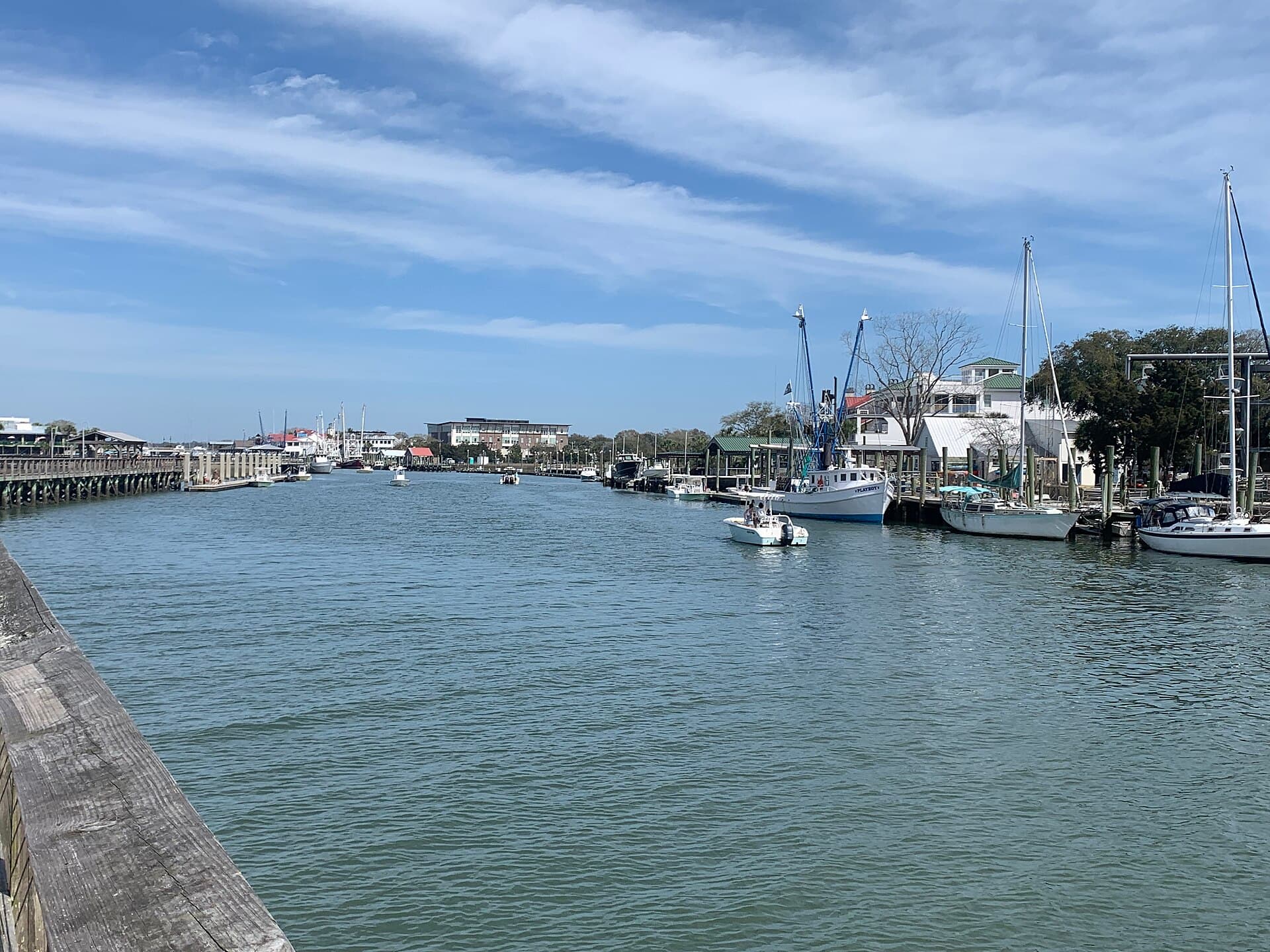
Shrimp boats, docks and marsh. This creek is Kildare's working waterfront.
The boat scenes run along this creek across all five seasons. The fleet works: boats leave early and come back through the afternoon, and the boardwalk out over the marsh is public and open at both ends.
Shem Creek, Mount Pleasant, SC
- Parking
- Shem Creek Park, on Shrimp Boat Lane, has a car park and is the usual place to leave the car for the boardwalks.
- Allow
- About 45 minutes here
 RJ Matthews, CC BY-SA 3.007
Stop 07 · Outer BanksIn the pass
Charleston Harbor Marina
The scene
Slips and gangways that stand in for the Kildare docks.
Charleston Harbor Marina, Mount Pleasant, SC
 w_lemay, CC008
Stop 08 · Outer BanksIn the pass
Ravenel Bridge
The scene
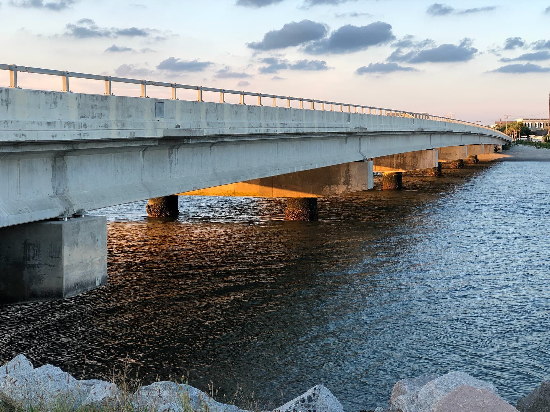
The crossing that separates the two halves of the island in the edit.
Arthur Ravenel Jr. Bridge, Charleston, SC
- Parking
- Free lot at Mount Pleasant Memorial Waterfront Park for the Wonders' Way path
- Allow
- About 60 minutes here
 Warren LeMay, CC009
Stop 09 · Outer BanksIn the passEvents venue
Lowndes Grove
The scene
The house that plays Tannyhill.
Lowndes Grove is an events estate on the Ashley River, which is why it is on this route: it is not somebody's house, and it is booked most weekends for a wedding.
266 St Margaret St, Charleston, SC
- Admission
- A private events venue, usually hosting a wedding. There is no public admission and no walking the grounds. Best seen from the water or the road.
- Allow
- About 10 minutes here
 Kurtis Garbutt, CC BY 2.010
Stop 10 · Outer BanksIn the pass
Folly Beach
The scene
The Morris Island Lighthouse stands offshore at the east end, and is widely named as the Redfield Lighthouse. It is not. Netflix places the Redfield at Hunting Island, in Beaufort, and the scene has the pair walk up to it past a keeper, which nobody can do here: Morris Island is out in the water and reachable only by boat. This is the view, not the location.
Folly Beach, SC
- Parking
- Folly Beach County Park, at the west end, is the reliable car park. Charleston County Parks charge by the vehicle and by the season: $5 in January and February, $10 in March, $15 in April, $15 on weekdays and $25 at weekends and holidays from May to Labor Day, $15 in September, $10 in October, $5 in November and December.
- Allow
- About 120 minutes here
- Worth knowing
- The lighthouse itself sits offshore and is not reachable on foot. Seeing it up close means a boat.
Also used in Dear John
 DThomson7, CC BY-SA 3.011
Stop 11 · Outer BanksIn the passPrivate
Kiawah Island
The scene
The Island Club, where the Kooks hold Midsummers.
It doubles as the hotel where JJ works when the group needs a computer. The Ocean Course carries Rafe's golf scenes. The island is residential and gated, so the resort itself is not somewhere you can drive up to.
Kiawah Island, SC
- Admission
- The island is gated and day visitors are turned back at the gate. Beachwalker County Park, 8 Beachwalker Drive, is the only public way in, and it has its own parking fee. The Ocean Course and the resort are for guests, so this stop is what you can see from the public end.
- Parking
- Beachwalker Park is the only public parking on the island and it has 150 spaces, which usually fill by 10:30am in summer. It charges the county beach park rate. Arrive early or you will be turned round at the gate.
- Allow
- About 45 minutes here
Before you set off
- Where does The Pogue Route start and end?
- It starts at Palmetto Islands County Park and ends at Kiawah Island. The stops are ordered so the route does not double back.
- How long does The Pogue Route take?
- About 5h 53m for 11 stops, covering 72.9 miles. That is measured driving time plus the time each stop is worth, not the drive alone.
- Do I need to pay to do The Pogue Route?
- The locations, the order and what was filmed at each are free to read on this page. The pass covers carrying the route in the app, which sorts the stops by how far away you are, tells you when you have arrived, and works with no signal.
- Can I get into every stop on The Pogue Route?
- Not all of them are walk-ups. Kiawah Island is private. The rest are public and free to stand at.
- What was filmed on The Pogue Route?
- Outer Banks, across 11 locations in and around Charleston.